
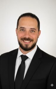
Results-driven Geomatics Surveyor and 3D Reality Capture Specialist with 10+ years of experience in hydrographic, topographic, and geospatial surveying across Saudi Arabia and Egypt. Proficient in GNSS data processing, mobile mapping, and LiDAR workflows, with extensive experience in reality capture, 3D scanning, and feature extraction using Trimble, Orbit 3D, and photogrammetry tools. Proven track record supporting national giga-projects including NEOM – The Line and Green Riyadh, training 120+ professionals in GNSS and 3D scanning workflows and resolving 90% of technical support cases on first contact. Combines strong technical leadership with client training, engineering consultancy, and business development

Ahmed Hareidy
مساح معتمد ✓Geomatics Surveyor & 3D Reality Capture Specialist
ِAl Jehat Company for Trading & Contracting, Trimble Authorized Dealer, KSA · Dammam - Saudi Arabia · 11 Years سنة خبرة
نبذة عني
مسّاح جيوماتكس ومتخصص في التقاط الواقع ثلاثي الأبعاد، أمتلك أكثر من 10 سنوات من الخبرة في أعمال المساحة الهيدروغرافية والطبوغرافية والمساحة الجيومكانية في كل من المملكة العربية السعودية ومصر. لدي خبرة قوية في معالجة بيانات GNSS، وأنظمة المسح المتنقل (Mobile Mapping) ، وسير عمل الليدار (LiDAR)، بالإضافة إلى خبرة واسعة في التقاط الواقع، والمسح ثلاثي الأبعاد، واستخراج المعالم باستخدام تقنيات وأدوات Trimble وOrbit 3D وبرامج الفوتوجرامتري.
ساهمت بنجاح في دعم مشاريع وطنية عملاقة مثل نيوم "ذا لاين" ومشروع الرياض الخضراء، كما قمت بتدريب أكثر من 120 متخصصًا على تقنيات GNSS والمسح ثلاثي الأبعاد، وتمكنت من حل أكثر من 90% من الحالات الفنية من أول تواصل. أجمع بين الخبرة التقنية المتقدمة والقدرة على القيادة الفنية، وتدريب العملاء، وتقديم الاستشارات الهندسية، إلى جانب المساهمة في تطوير الأعمال وبناء العلاقات المهنية
التوثيق
مساح / فني مساحة — موثّق من إدارة الموقع ✓ · قسم جغرافيا ونظام معلومات شعبة مساحة وخرائط
الخبرات العملية
•tActed as a consultant for Suez Canal Authority within dredging projectsrn•tConducted project traverse reception, initial surveys, and calibration approvalrn•tReviewed and approved survey extracts and reports
•tSupervised hydrographic and topographic survey teamsrn•tApproved plans, maps, dredging quantities, and ensured compliance with project standardsrn•tLed survey operations for major dredging projects in Egypt